
INSIGHT
GIS provides railroads a return-on-investment
Connect with us
Maps and geographic information are crucial for railroads to support their operations and strategic planning. Today, carriers need geographic intelligence more than ever to navigate the landscape of increasing regulations, data-driven competition, aging infrastructure and challenging operating environments.
As with other industries, the modern railroad has transitioned from paper maps and spreadsheets to GIS. This migration has happened because a well-designed GIS measurably improves a railroad’s ability to access and use geographic data and maps to support critical business operations, ultimately addressing the fundamental question: “What is where?”
As with any investment, it’s essential for a business to understand what they will get back from it. With GIS for railroads, the specific return-on-investment (ROI) depends on the use cases and implementation strategies the carrier targeted. For example, GIS technology is known to enhance the management of extensive, geographically dispersed assets, leading to improved operational efficiency, better decision-making, and cost savings. But that’s just scratching the surface, and other benefits derived from GIS can include safer operating environments, improved security along track right of way, or even new revenue streams. Point being, GIS is a foundational technology for railroads and opens the door to a variety of benefits. To illustrate some of these, several examples of how railroads are deriving GIS ROI are provided below.
1. Accurate Track Mileage Unlocks Tax Credits
It’s hard to know exactly what you have until you measure it. Case in point, by digitizing their property records and track data then loading into GIS, a regional railroad operating in the U.S. discovered they owned more track than previously thought and had been under- reporting track mileage to the federal government. Using the newfound track mileage identified via the updated track inventory stored in GIS, the carriern is now able to report many more miles than previously reported under the Federal 45G tax credit program.
2. GIS Based Property Management Accelerates Record Retrieval
One of the earliest use cases for GIS was (and continues to be) storing and managing property data. Hosting property boundaries and real-estate data in GIS and serving it to users via an intuitive map interface takes the guesswork out of finding property records and measurably decreases the time it takes to find and retrieve property information. For example, after a well-known rail and real estate holding company digitized its property records and loaded them into GIS they saw near immediate efficiency gains across multiple departments, reporting that property look-ups were reduced from half an hour per look-up to “just a few clicks.” For more details, see “Railroad Company Digitizes with GIS and ‘Everything Changes’” in Fall 2023 ArcNews.
3. Digitization of Property Data Clarifies Ownership and Alleviates Risk
A good map tells a clear story and the data behind the map backs up the facts. For example, after digitizing its property records as part of its GIS mapping program, a regional railroad in the U.S. found themselves better positioned to renegotiate terms with other carriers regarding what they did and did not own. In this case, their GIS was used to identify and document their ownership rights to approximately 10 miles of track that had, up to that point, been incorrectly claimed by another carrier. Conversely, they also discovered stretches of track mistakenly marked as theirs and can now work to transfer the management costs and the associated risks of these stretches back to the rightful owner.
4. Map the Right-of-Way to Protect It
Trespassing on railroad property is a leading cause of rail-related deaths in the U.S. While there are many ways to approach the problem, accurate delineation of the railroad right- of-way is a logical first step. After the right-of-way boundary is clarified, preventative measures such as fencing, signage, cameras and other deterrents can be implemented and combined with active monitoring of the protected areas. Along these same lines, railroads can also use GIS to track and map the history of trespassing and encroachments on their property and/or run predictive analysis to identify locations where trespassing is most likely to occur. Ultimately, clear delineation of railroad ROW in combination with GIS mapping and analysis can work to increase safety and save lives by making it easier to identify, predict and protect against trespassing and other encroachments within restricted areas.
5. Identifying Landcover by Parcel Leads to Carbon Sequestration Credits
North America Railroads run across a variety of natural environments from grassy plains to forested mountains. GIS can help a railroad understand what environments they traverse and, in some cases, derive benefits from this knowledge. For example, a regional railroad operating in the United States obtained carbon sequestration credits from the federal government by using GIS to identify and report their forested parcels. Without GIS to draw on, field and/or aerial surveys would likely be required to collect this type of information, ultimately making it cost-prohibitive to identify this information and act on it for sequestration credits. With GIS, these sorts of land cover summaries are simple and fast.
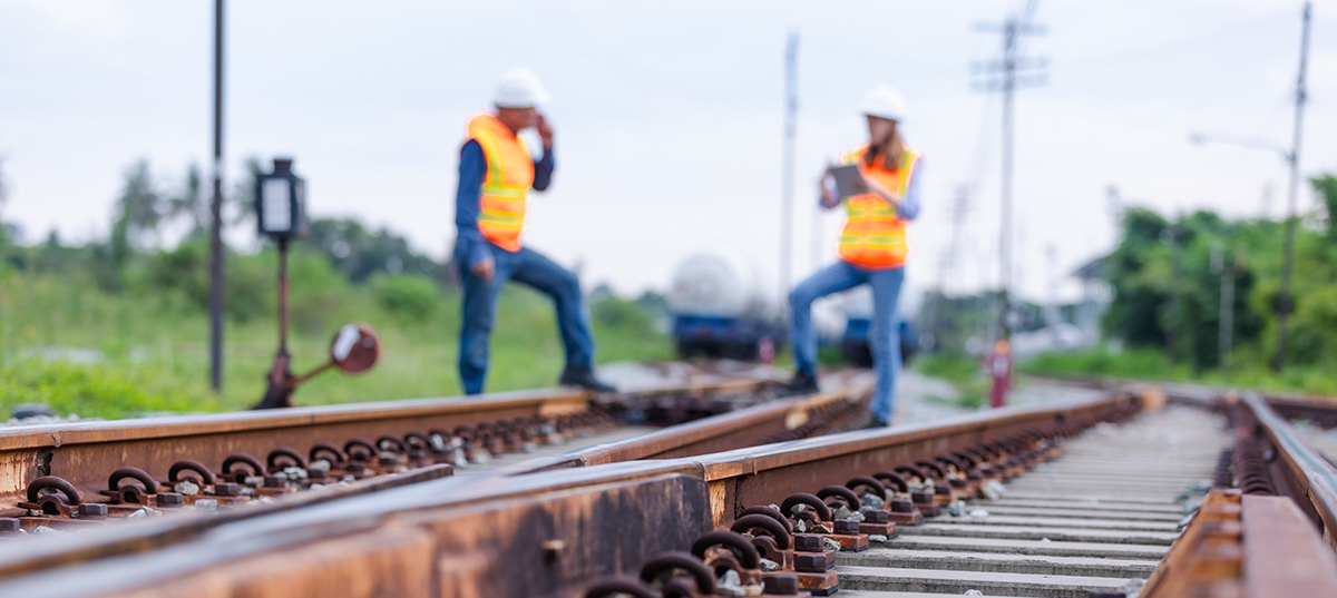
6. Taking Advantage of Mobility
Data is most useful when it’s available directly where it’s needed and often this is to crews working in the field. For regional railroads that have multiple operations spread across the US, delivering information to the field in a way that is easy to understand for general managers, roadmasters, track inspectors and real estate professionals through a smart phone, tablet device or laptop can result in significant financial benefits to a railroad. Enhancing field workforce spatial awareness relative to engineering, real estate and other non-owned assets streamlines work orders, routing, change management and decision making.
Tell us about your project
We’d love to work with you. Tell us the services you are seeking and one of our team members will connect with you.